The Second Tibetan Plateau Scientific Expedition and Research (STEP) monitored water vapor movement and earthquakes in Lulang, Southeastern Tibetan Plateau.
Core issues of STEP
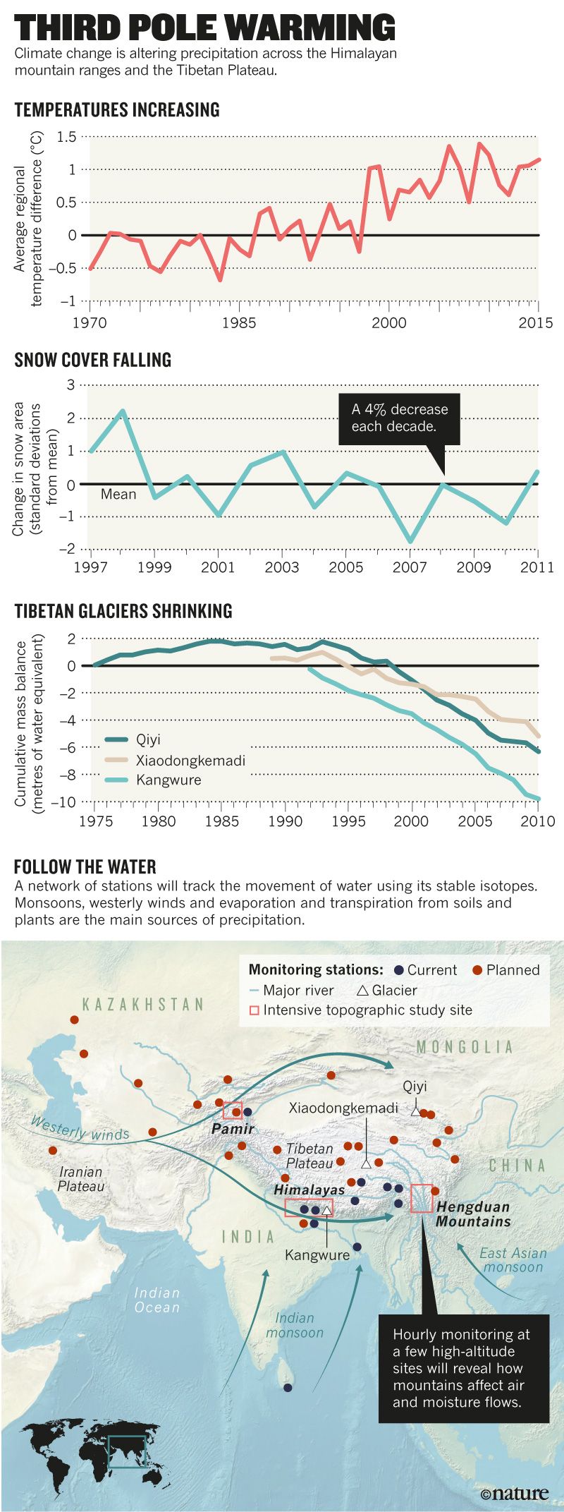
Officially launched in August, 2017, STEP focuses on the environmental changes in the Asian Water Tower, on which almost one-fifth of the world’s population depends. The warmer and wetter climate is altering precipitation across the region, causing huge natural disasters, according to the latest STEP studies released in September, 2018. The studies observed the shifts in glaciers, snow cover, permafrost, lakes, and atmospheric environment in the third pole region.

Source: Nature
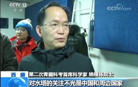
Currently, the top priority must be to study the moisture flow driven by westerlies and monsoons. In October 2018, two glacier debris flows occurred in the big turn of the Yarlung Tsangpo River, creating barrier lakes and debris that dammed the river. Given such disasters, communities need more information on the region’s movement of water as soon as possible to help them manage risks as well as water supplies, said Yao Tandong, chief scientist of STEP and academician of Chinese Academy of Sciences.

Yao Tandong, chief scientist of STEP and academician of CAS (Source: CCTV)
Tethered balloons for expedition
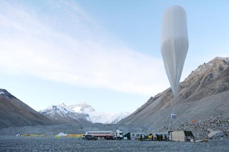
Starting from the second day of January, 2019, observations of the atmospheric water vapor transport were carried out in Lulang, Southeastern Tibetan Plateau by an expedition team of over 40 researchers. Lulang stands in the water vapor pass along the Yarlung Tsangpo River, an important gate through which the Indian monsoon brings moisture towards the third pole. Unlike the past observations, tethered balloons carried the observation instruments for the very first time in order to take a bird’s view of the origin of atmospheric moisture in the whole region. After working overnight for 15 days and putting the tethered balloons in the air for 6 times, the team managed to acquire crucial data on the stable isotopes in water vapor at the altitude of 6204 meters and thus laid a solid foundation for establishing a three-dimensional observation system for the moisture flow in the Asian Water Tower.

Tethered balloons prepared for observations of moisture flow in the air (Source: Nature)
As China's first major expedition program in 2019, these observations were supported by STEP and the Pan-Third Pole Environment Study for a Green Silk Road by CAS, with the researchers coming from the Institute of Tibetan Plateau Research, CAS and Aerospace Information Research Institute, CAS.
Monitoring stations
Besides the tethered balloons, the network of 10 monitoring stations was used by the scientists to monitor the earthquakes along the Yarlung Tsangpo Grand Canyon, which proved to be helpful to the monitoring and pre-warning of the recurring icefall disasters in the Canyon. Since 1970, about 600 earthquakes of 4 magnitude and beyond struck the region, with the 1950 Chayu Earthquake among China’s strongest on record. On November 18th, 2017, a 6.9-magnitude earthquake occurred in Milin County (located in the Canyon) and on October 17th and 29th, 2018, two glacier debris flows happened at Sedongpu at the foot of Mount Gyala Peri (at the entrance to the Canyon), blocking the rivers. Thanks to the monitoring network, the subsurface faults and the starting time, duration, and direction of the debris flows all explicitly demonstrated in the seismic waveform data.

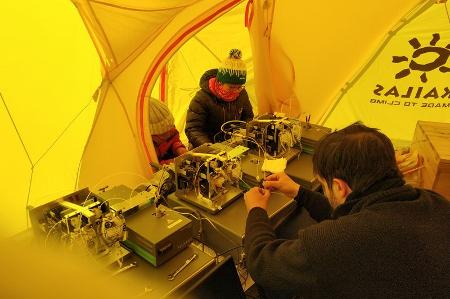
Researchers set up instruments to measure stable isotopes in atmospheric water vapor. (Source: Nature)


